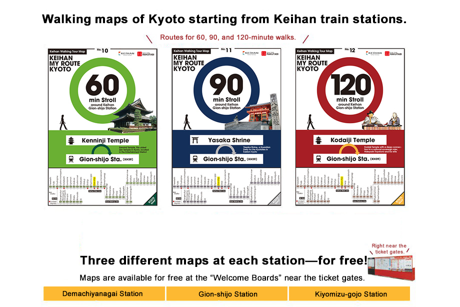
About the Keihan My Route Kyoto Map
A walking map of Kyoto along the Keihan railway. Comes in three separate routes to be completed in 60, 90, and 120 minutes, each one starting and ending at a single Keihan train station. Pick the route that's right for you.
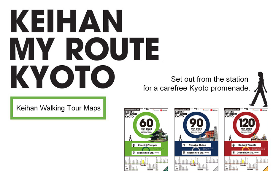
Features
- [1] Curated routes for leisurely strolls of an hour or more.
- Arrive back at the station in 60, 90, or 120 minutes, perfect for making the most of the free time before your next train.
- [2] Routes created by Kyoto travel experts.
- Routes created by Rakutabi, producer of many successful Kyoto travel plans. Enjoy the many charming locales along the Keihan Line through a tour guide's eyes.
- [3] Each map features a column about Kyoto history and culture.
- Includes information on the temples and noteworthy sites along the route. Gain greater understanding of Kyoto culture as you walk through it.
How to use the Keihan My Route Kyoto Map
- [Step One] Take a map
- Maps are available for free at the "Welcome Boards" near the ticket gates.
- [Step Two] Walk!
- More than just a chain of locations, each map presents its route in detail. The area surrounding each route, along with temples, souvenir opportunities, and gourmet eateries are all described inside.
- [Step Three] Try them all!
- Three routes presented for each of six different stations means eighteen different walking tours!

Availability
All three routes now available at six different Keihan stations!
Maps are available for free at the "Welcome Boards" near the ticket gates.
Try all eighteen routes for a full experience of the Keihan Railway area!
[Participating Stations:] Demachiyanagai Station, Gion-shijo Station, Kiyomizu-gojo station